
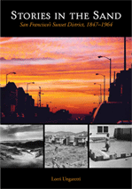
Book Introduction

In the 1800s, what is now the Richmond District was part of “The Outside Lands,” which were not part of the City of San Francisco, and in those days, no one believed that the Outside Lands would ever be part of the city. Early maps called the area “Great Sand Bank” because it was composed primarily of sand dunes. Originally owned by Mexico, the Outside Lands were annexed by the U.S. federal government in 1848 and made part of the City and County of San Francisco in 1866. At that time, the city set aside parts of this land for parks (including the1,017-acre Golden Gate Park), schools, fire stations, and a city cemetery.
How did this northern part of the Outside Lands come to be known as the Richmond District? In 1876, George Turner Marsh (1857–1932) came to San Francisco and in the 1880s built a home at Twelfth Avenue and Clement Street. He named the home “Richmond House” in honor of his birthplace, Richmond, Australia. In 1890, the Point Lobos Improvement Club suggested the name “Richmond” for the entire district, honoring Marsh’s early residency and standing in the neighborhood. On November 24, 1890, the board of supervisors designated the land that is now west of Arguello to the beach, from Golden Gate Park to the Presidio the Richmond District. (Some people name Masonic and Presidio as the eastern boundary of the Richmond. This book uses that boundary.)
In November 1917, the board of supervisors, to avoid confusion with the city of Richmond, passed an ordinance changing the name to Park-Presidio District. But the new name never really stuck.
People often lump together the Richmond District and the Sunset District. There are similarities: both districts were originally sand dunes and part of the Outside Lands; both are now heavily residential; both border Golden Gate Park; both have streets arranged in a grid pattern; and both have similar weather patterns—cold, foggy summers and clear, cleaner air than downtown. However, their histories are distinctly different. The Richmond District developed much earlier than the Sunset and in diverse ways.
Transportation came early to the Richmond District, starting with a toll road for horses and buggies in 1865. By 1888, riders could take a steam train to the beach to enjoy the sights at Sutro Heights, the Cliff House, and Sutro Baths.
The area was far from the center of the city and far from where most people thought they would ever want to live—a good place for cemeteries. The first cemetery was built in the Richmond District in 1854, and soon there were five in the area. According to Charles Lockwood (Suddenly San Francisco, 1978), people went to the cemeteries for a quiet respite: “On pleasant afternoons well-dressed families walked along the paths, with their maps and guidebooks in hand, while the carriages rolled up and down the winding hills.” After Golden Gate Park was built in the 1870s, people flocked there to rest and recreate.
The city continued to grow westward and by the 1880s, people began calling for the closure of the Richmond District cemeteries. Both residents and developers saw the Inner Richmond, where four of the five cemeteries sat, as fertile land—not for farms but for housing. Burials within city limits were prohibited by law after August 1901. With no new burials, maintenance of the cemeteries deteriorated, while looting and vandalism increased.
In 1909, City Cemetery was closed and converted to Lincoln Park. The board of supervisors tried to evict the remaining four cemeteries but met with voter resistance. In 1923, a state law was enacted allowing cities to close cemeteries, and in 1937, city voters agreed to close the four Richmond District cemeteries. Some cemetery owners had already begun removing remains; others fought the closure, with at least one cemetery (Laurel Hill) remaining in place until 1941. By 1950, all Richmond District cemeteries were gone and the land graded for development.
When people wanted to play, they went farther out in the Richmond District, past most of the cemeteries. Some of the entertainment was considered proper—for example, the Bay District Race Track, Sutro Baths, Chutes, and Playland-at-the-Beach. More dubious forms of entertainment included road houses and saloons, far from the eyes of neighbors or authorities. As the years passed and more people built homes in the Richmond District, those neighboring “eyes” were everywhere, and the unsavory destinations began to close.
This book is divided into six chapters.
Chapter One: The Early Years looks at the 1800s and early 1900s, when few houses or businesses existed in the Richmond District.
Chapter Two: The Cemeteries discusses the five cemeteries that covered land in the Richmond District between 1854 and the 1940s.
Chapter Three: Transportation discusses steam trains, cable cars, and streetcars, and later the buses that run through the Richmond District today.
Chapter Four: The City’s Playground describes the race tracks, sports fields, road houses, and amusement parks that drew citizens to be entertained “outside” the city.
Chapter Five: Churches, Schools, and Other Public Buildings features some of the structures and groups that helped meet the increasing needs of Richmond District residents.
Chapter Six: Daily Life grows out of Chapter Five, showing some of the people and businesses that have been part of the neighborhood.
Many of the attractions that drew nonresidents to the Richmond District no longer exist. Most road houses and saloons were gone by 1900. The cemeteries disappeared between 1909 and 1941. Sutro Baths closed in 1964, and Playland-at-the-Beach was razed in 1972. But all of these destinations contributed to the rich history of this “Outside Lands” community. What remains is a thriving residential neighborhood—or, more accurately a group of neighborhoods—in the northwestern corner of San Francisco, the Outside Lands no more.
© Lorri Ungaretti